


Earth's axial tilt from space
What satellites show us from a different POV

This week is the Spring Equinox, one of four iconic milestones the Earth passes through during its annual orbit. For the first ~300,000 years humans have lived on the Earth, the equinoxes and solstices were only observed from the Earth’s surface, looking up at the angles of the Sun’s arc across the sky. Only in the past few decades have we had the technology to observe the Earth from space, which will be the focus of this post. Take a look at a whole year of images from space from the exceptional scientists and staff of the United States National Oceanic and Atmospheric Administration (NOAA):
Thinking about ancient cultures, phenomena like solstices, equinoxes, and eclipses had to have been so mysterious, so much so that entire monuments and buildings were constructed in alignment with the Sun. During the spring equinox at Chichén Itzá, the sun's rays create the illusion of a serpent descending the pyramid of Kukulcán, a phenomenon that draws thousands of visitors each year from March 19 to 23.

I wrote about this topic eight years ago and thought it was time for an update and refresher. This year, 2025, science is under attack in the U.S., with thousands of scientists fired from the government and budgets slashed. By way of comparison, research at NASA, NOAA, and NSF accounts for about 0.7% of the US federal budget:
Notably, most of this blog post's data, measurements, and imagery come from the iconic U.S. scientific agencies NASA and NOAA. Scientists have measured the Earth's axial tilt: 23.4 degrees. This is an essential attribute of our planet and plays a significant role in making it habitable. The tilt causes seasons, which sustain life. You wouldn't be reading this post if Earth’s axial tilt were more like Mercury’s or Venus’s.

Making it more interesting, we know (by scientific studies) that the angle of the Earth’s tilt oscillates between 22.1 and 24.5 degrees over a ~41,000-year cycle. It is slowly decreasing at a rate of 0.013 degrees per century. Theoretically, the current trend of reducing tilt will promote milder seasons (warmer winters and colder summers) and an overall cooling trend.
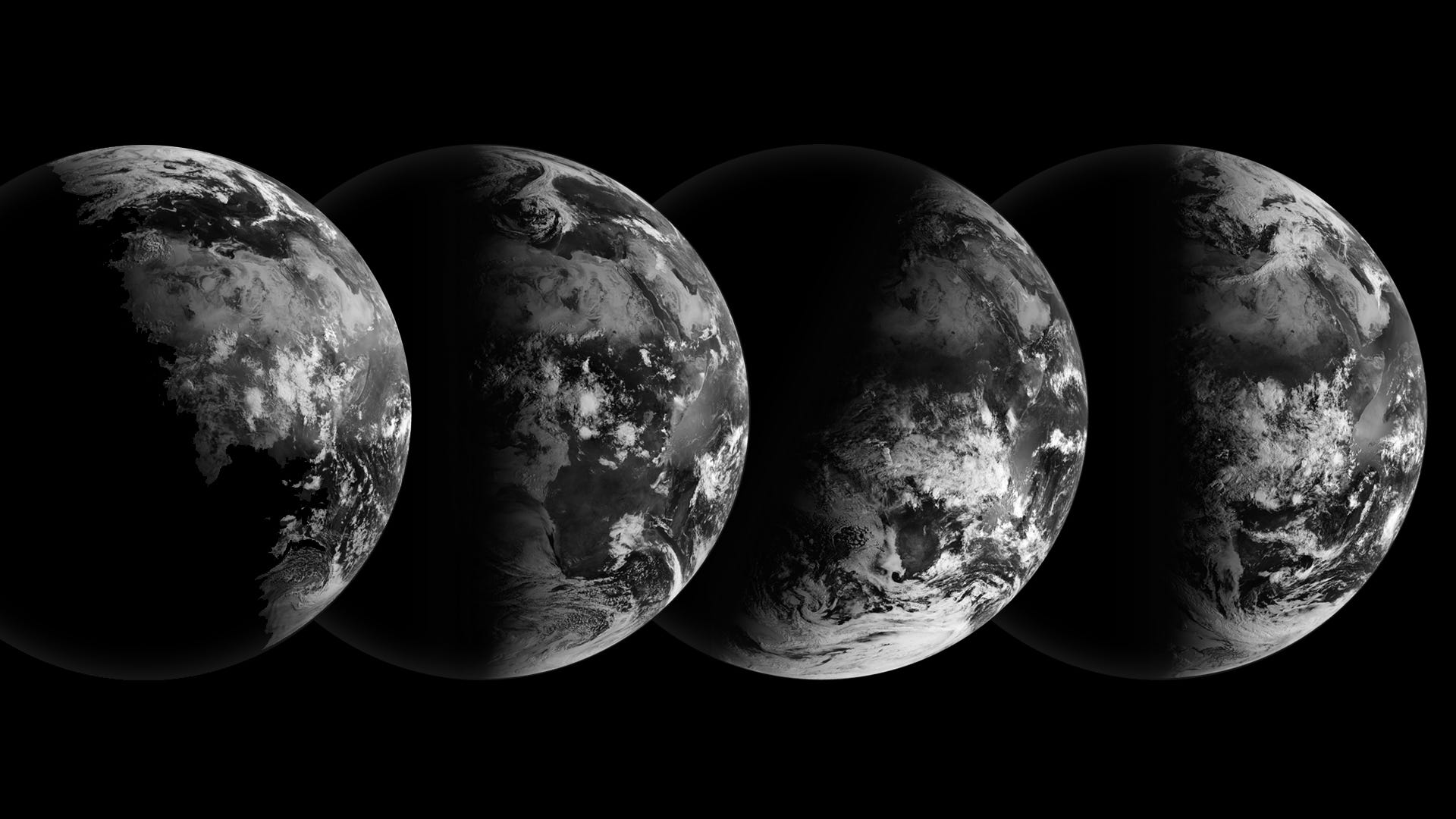
This series of images, acquired by the Meteosat-9 weather satellite via the archives of NASA Earth Observatory, shows our planet at four critical points on its annual orbit around the sun: the June Solstice, the September Equinox, the December Solstice, and the March Equinox.
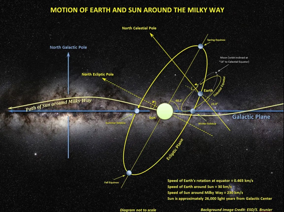
Meteosat-9 and many other weather satellites orbit the Earth in a geosynchronous orbit. Sometimes called “GEO,” this orbit has a period exactly equal to one revolution of the Earth (~24 hours). The orbit's altitude is 35,786 km, and the speed of the orbit is about 3km per second (~22,200 miles and 6,711 miles per hour, respectively). Earth appears stationary from this perspective, but when you think about it, that satellite is moving fast through space, considering its orbit around Earth, Earth’s orbit around the Sun, the Sun’s orbit around Sagittarius-A, and the Milky Way’s movement through space toward the Great Attractor. 🤯
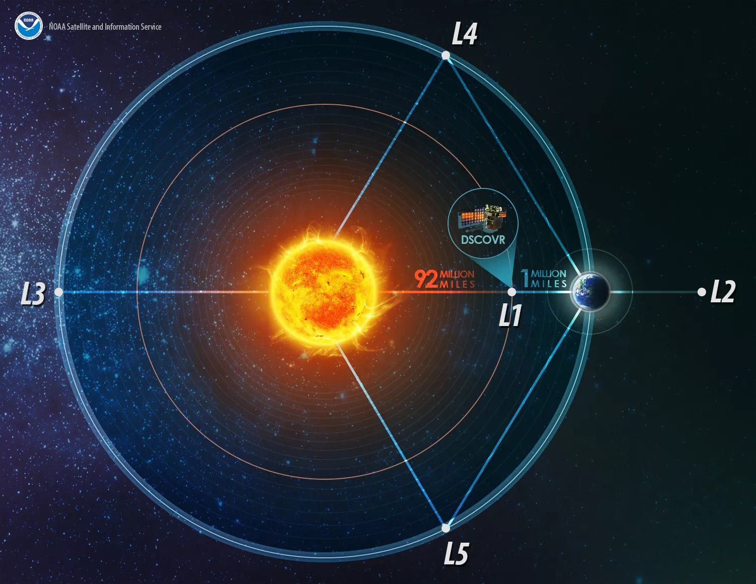
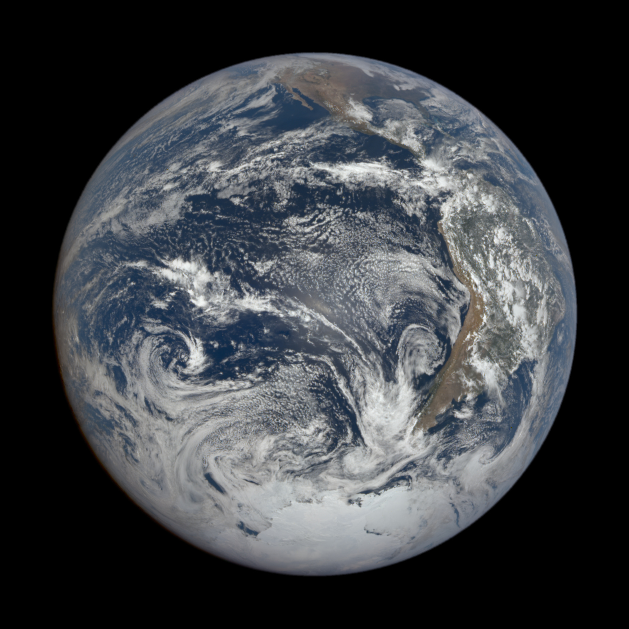
NASA's Deep Earth Climate Observatory (DSCOVR) is one of my favorite Earth-observing satellites. It sits (orbits) in an elegant location, orbiting “L1” or Lagrange Point 1. A place between the Earth and the Sun where the gravitational pull is null, about 1,600,000 km from Earth. There are five Lagrange points; L2 became famous when the James Webb telescope became operational.
From this vantage point, the Earth Polychromatic Imaging Camera (EPIC) takes images once every 2 hours with sensors measuring spectra in 10 different wavelengths. The other sensors on DSCOVR measure solar wind (which can warn scientists of large solar activities) and radiation. Check out this image below from Dec 21, 2024 - last Winter’s solstice. Towards the top of the image, you can see Baja California, Mexico, and the Southwestern United States. Canada is basically at the “top” of the planet, where we would expect the North Pole. We can also see most of Antarctica basking in the sunlight. This is why we have polar night in the winter and midnight sun in the summer: during the Winter solstice, the tilt of the Earth keeps the high northern latitudes in darkness throughout the rotation of the Earth’s 24-hour period. Conversely, during the Summer solstice, the tilt of the Earth keeps high northern latitudes in the light throughout the 24-hour period.
Compare this to the same observation made during the 2024 Summer Solstice on June 20th. The United States is now toward the “middle” of the image, much further south than the Winter Solstice. Most of Canada and Alaska are also basking in the sun, while Antarctica has “disappeared.”

Here’s something I find interesting: the Earth may have a 23.4-degree tilt, but the difference (delta) between the Winter and Summer solstice is effectively double: 46.8 degrees. Another way of saying it is that during the winter solstice in the northern hemisphere, we are leaning “back” at 23.4 degrees, whereas at the summer solstice, we will lean “forward at 23.4 degrees:

Given that the “field of view” from the Sun to the Earth is 180 degrees (i.e., the sunlit side of the Earth), the shift is essentially 1/4. (46.8 into 180). This is why Antarctica disappears when comparing the Winter to the Summer solstice. To visualize this, let’s go back to a Geosynchronous orbit and capture a full year of Meteosat-9 images in an animation.
Orbital dynamics is an amazing phenomenon; I understand why ancient cultures were obsessed. When you look to the skies, create a mental picture of your location on the Earth (longitude, latitude), what part of Earth’s rotation (time of day) is, and your place in the orbit (season) you are in.